


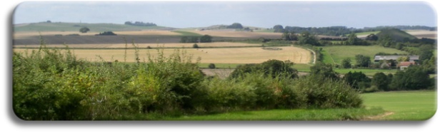


Area covered in 2016
Our Guided Walks are based on an area centred on Marlborough in Wiltshire which extends north to Swindon, east to Hungerford, south to Salisbury and west to Calne. This area covers much of the North Wessex Downs, one of the larger Areas of Outstanding National Beauty. The area includes the Upper River Kennet Valley, Marlborough Downs, Pewsey Vale, and the various woods and forests that were originally part of the 40,000 acres of Savernake Forest. Savernake now exists as a 4500 acre privately-owned forest; other woods in the area include West Woods, Collingbourne Forest, Harewood Forest, Bedwyn Brails and Stype Wood. Several Long Distance Trails traverse the area, including the Wessex Ridgeway, Ridgeway, Herepath, Wansdyke, White Horse Trail, Mid-Wilts Way and Tan Hill Way, which passes the highest point in Wiltshire.
Difference
Our Walks are distinctly different from those ‘freebies’ that you may have found on the Web, and from the more disciplined ‘enthusiast’ walks that are held in the UK National Parks or along the Long Distance Paths. Our half-day Walks are considerably more than a local footpath ‘dog walk’, but the full-day Walks are certainly not a 25 mile ‘hike’ across rough and difficult terrain. The half-day Walks range from 3 miles to 8 miles, which are easily achievable by anyone who is, let’s say, ‘averagely fit’; our full-day Walks range from 10 to 20 miles, for which a little more stamina is required. Failure on a full-day Walk is generally due to poorly fitting or new footwear, and not due to the level of the Walkers fitness or stamina!
A few facts.....
- We know of no other organisation in Wiltshire offering the same service as ours......
- Our prices are around half of those charged by companies providing other Countryside and National Park Guided Walks.........
- A four hour half-day Guided Walk from us will cost less than a two-course meal at any of the High Street restaurants in Marlborough......
Preparation
Each Walk has been meticulously prepared - the success for any walk is in the detail. Firstly, our Walks are produced by one of our Path Leaders who will know the area well - the local Points of Interest (POIs), Rights of Way (RoWs), terrain, ground conditions in summer and winter, viewpoints and local history. Using these details a preliminary route is prepared, usually following a logical sequence, with any major ascents placed during the early stages of the walk. Each POI, land feature, ‘obstacle’ (such as stiles and gates), viewpoint etc., is then assigned as a ‘Waypoint’ and entered into our Mapping software, based initially at a scale of 1:25,000 (4cm to 1 km).
If a section of the Walk is unknown, then an exploratory journey is made. This will reveal any terrain problems and can be used to check for viewpoints and photography suitability. A digital camera accompanies the Path Leader, as does a GPS device to record Waypoints and the Track of the journey taken.
Click here for information about ‘Waypoints, Tracks and Routes’
We now have enough information to produce our Walk. Initially a circular tour is prepared to cover all the POIs and area required. This is unlikely to be perfect, and minor changes will be required to sequence the POIs correctly, and to ensure that only Rights of Way and Permissive Paths are used. The distance of the Walk is now measured, and the time required for the Walk calculated. Thankfully our software is capable of doing all this automatically - including the extra distance and time required due to terrain features. N.B We do not use the ‘professional’ Naismiths figure of 3 miles per hour, instead we use 2.25 mph, coupled with a 2 minute per 10m ascent/descend addition, and a 2 minute Break-Time addition. The total time required for the Walk is then calculated, by adding 10 minutes per major POI/viewpoint and a 20 minute break per two hours. Experience has shown that we are rarely more than 5% out using these calculations.
Now we can put this all together - we produce our internal Route Cards for the Walk which contain not only Waypoints and POIs etc., but also reminders for the Leader during the actual Walk. Photographs and diagrams are taken from our vast library which stretches back over 60 years, and annotated as required for use by both the Leader and for illustrative purposes during the Walk.
The Route (and other diversionary routes) are now overlaid onto our internal Maps, along with POIs and other features of note. Our software can now generate our Maps for printing as well as various datafiles that can be used with our GPS and Portable Mapping software.
Everything is now collated into our Path Leader Folder, along with any documentation required for distribution to the Walkers. See the Gallery below for a few examples.

| Avebury |
| Kennet Valley |
| Martinsell |
| Marlborough |
| Savernake |
| Villages |
| West Woods |
| Custom Walks |
| Self-Guided Walks |
| Map & Compass |
| Ley Line Dowsing |
| Ancient Trees |
| Walking for Beginners |
| Beginners Backpacking |
| Geocaching |
| Corporate |
| Activities |
| Corporate |